Here's a practical technique that works well:
- Get a photo from google images that has the point-of-view you want; what's in it doesn't matter, though buildings are helpful (you'll see why). Here's one:

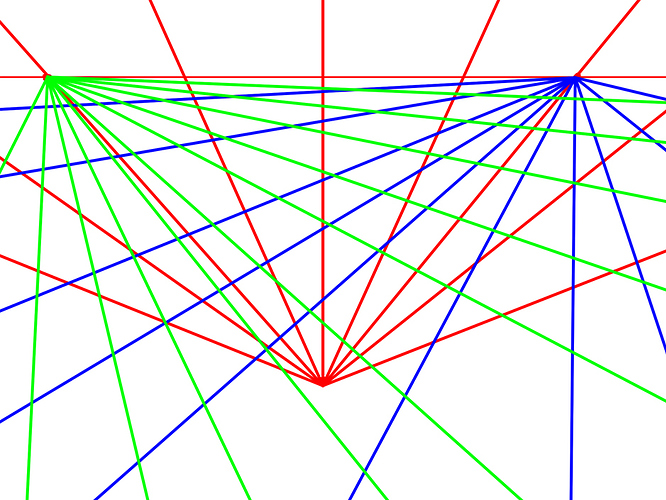
- Use the image to create your perspective grid (trace it right over the photo). The horizon is easy to find (in some pics, it will be out of the frame.) This is a two point perspective, and that fence around the lighthouse fits it like a glove. Trace a line along the edge of the fence, and continue it up to the horizon. Do the same on the perpendicular part of the fence, again to the horizon (it will intersect off the side of the page). Now you have your two vanishing points.
With the horizon in the picture, you won't likely have a third point. However, if the horizon is high above the top edge of your photo, trace the vertical edges of some buildings down to where they meet below your image; this will be your third point. In this image, you can see almost exactly where they will meet:

Once your grid is drawn, it should look something like this (except from above):

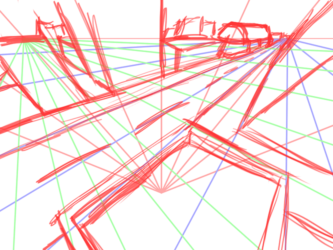
- At this point, simply draw in your own scene over the grid you've created. You can keep the photo visible to give you a sense of how stuff aligns with the grid, and even use the basic shape of some buildings, while adding your own details.
That's it; it's a relatively quick and easy way to get a good aerial shot without too much labor. Hope that helps.