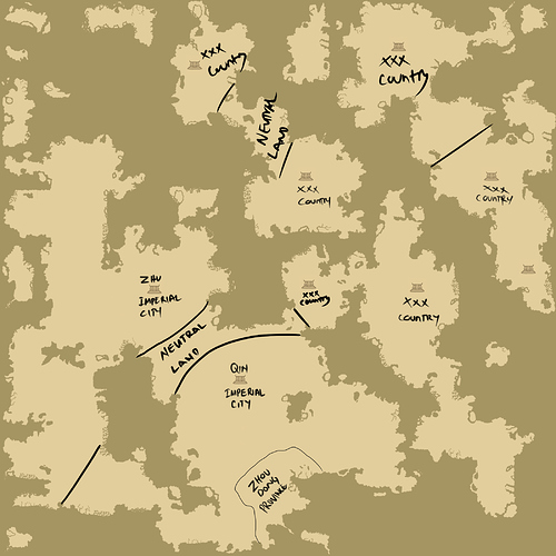
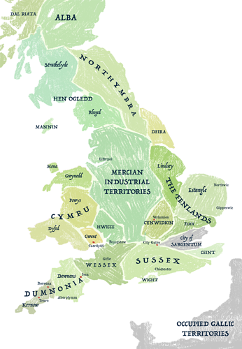
27 / 39
Jul 2019

I did this a while ago:

It's a map of a Netherworld region from an old comic about reapers. I had a lot of fun with this, but it took me a while as I drew it by hand.

If you look closely at the borderline, it's supposed to be shaped like their worshipped dragon head with the palace and academia as the eyes (the dragon has 4 eyes, 2 on each side so that's why they're next to each other).
Also the train line is so short and near the cliff because there's portals on both ends of the tracks (so it's not like it's going off in the void).
There's a restaurant in the Lake Lorelei, and there's a mermaid performing some singing for the dining guests.

Loser?! It sounds super fun for me. :smiley: This could be put into "extra" series or just uploaded at the end of suitable chapters of the novel. Like, you know, some serious anime series are ending every episode with a gag, made in much less serious style.

Yes, unfortunately, I destroyed the most of drawings I've made before 25 y.o. (I think), because of self-hate. Now I certainly regret about it! (but it's too far off-topic))

You just made me realize that it has been a while since I drew maps. These are almost 10 years old D: I made these for a friend's RPG project, which is the same world as the series of illustrations I was posting on instagram a while ago, about the two dark elf-looking kids.

Looking for these I found a bunch of unfinished maps adds them to task list

Here's mine!
It's a bit lackluster, but it'll do


my comic2 is set in an alternate universe britain! i based my map off real kingdoms that did once exist in these places, some being celtic kingdoms, and others being part of the later anglo-saxon heptarchy. most of these place names are still in use to varying extents to this day.

i did use a load of artistic licence here though - sargentum never existed, it's purely fiction but it occupies a similar place (albeit completely different shape) to modern day london. the other town names are in their old english forms with a few exceptions, and welsh names in welsh, cornish in cornish etc
i'm just a huge fan of etymology so this was INCREDIBLY indulgent haha

edit: is this coming up blurry on other screens? i've tried larger and smaller versions and they've all come out blurry and gross, idk what to do

I like doing maps, though I've yet to make it for cities which might be more useful for the time being. For the islands in my comic Splitting Image, I used this Fantasy Map Generator to make believable edges on the terrain then drew my own landscape/locations/rivers, but be wary that it's gonna take a lot out of your browser and it might just end up crashing depending on the settings.

Here's an example of what I made! This is the first island that gets the most screentime, Boreas. I didn't name a lot of locations since they're not relevant right now, but I'll keep the files for updating purposes just in case.

I want to draw up a map, but my brain just has no idea where to start...:tired_face:

stat by working out who lives on the map. no point in drawing a dessert if all you have is rock dwellers. everything needs water so work out the water source first and go from there.

Thanks for the tip! I think scale is the hardest thing for my brain to wrap around!

That's very nice!
Actually, I'm also working on a type of map that sits somewhere in the middle in term of abstraction.
That's an explanation of a slightly complex religion/belief system that I present as a sort of mindmap. Not as abstract as your universe map, but going into that direction.

These maps are very Tolkein-like in both their iconography and the coloring. That is what you were going for, right?

It was so long ago that I can't remember exactly, but might have been the case since my friend is a big fan of Lord of the Rings and I think back then I had the books and one of them came with a map. For the background I remember just playing with Photoshop brushes and going for an old parchment look :slight_smile: